Por Ecam
New Technologies and Traditional People: next steps of an innovative program

Self-management. Defense of territory. Cultural valorization. Practical tools for planning. Since 2007, the New Technologies and Traditional Peoples Program has been supporting indigenous peoples, maroons and small producers in the implementation of their practices to use their territories sustainably. All this through access, knowledge and autonomous use of powerful, new technologies.
To enhance the potential of these initiatives, a new project was just been approved, “Indigenous communities and other relevant actors better protect their territories and other natural resources,” made possible by the generous support of the American people through USAID. The project is carried out by the Equipe de Conservação da Amazônia (Ecam) and has as partners Google Earth Outreach, Imaflora, Natura, Fundação Palmares and Fundação Nacional do Índio (Funai).
The project’s premise is that technological innovations, such as the easy-to-access tools offered by Google, empower traditional communities in their territorial management and in sustainable use of natural resources. There will be 25 territories involved, among indigenous peoples, maroons and small producers, as well as public and private institutions.
How everything started
Two important moments mark the trajectory of the New Technologies and Traditional Peoples Program. In 2007, Google Earth Outreach was created. In that same year Almir Suruí, an indigenous leader, discovered the Google Earth tool. Almir immediately recognized the potential of this tool to improve the management of the Sete de Setembro Indigenous Land and insisted on contacting the Google Earth team. And Google Earth Outreach was created precisely for that: to give nonprofit organizations the knowledge and resources they need to tell their story in Google Earth & Maps to hundreds of millions of people.
The contact was fruitful and the Surui received training to use the tool in their projects.
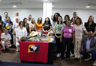
On 2015 that experience of the Suruí expanded. New trainings were held in Porto Velho, for about 40 people. These included the Tembé, Cinta Larga and Kayabi indigenous peoples; maroons from Pará, Espirito Santo and Rio de Janeiro states; and small-scale harvesters of non-timber forest products from Rondônia state. This enabled a much wider audience to become familiar with the tools, as had the Surui before them. This new project, supported by USAID, will permit many more communities and supporting institutions to gain access to Google technologies.
Free tools and spaces of representativeness
The project is based on the exchange of experiences and knowledge about Google Earth and Open Data Kit (ODK) and the virtual space of the Google Cultural Institute.
ODK is an open, simple and user-friendly data collection platform.
With constantly updated satellite images, Google Earth provides a basis for inserting information on online maps.
Cultural Institute is another space that offers online content produced in partnership with institutions, museums or associations.
Independently, these tools are already able to assist in the planning of specific strategies. Combined, they can help in visualizing data in a more integrated and attractive way, providing visibility to important needs of each community.
Rogério Pereira is a maroon who lives in Pará state. He has been working with Cultural Mapping in Google Earth since 2015. For Rogério, starting this work was a great challenge: “For those who are accustomed to working with a machete, a hoe and an ax, picking up a computer is a challenge. But the purpose of this mapping is to enable us to know our territory better”.
What do we expect for 2020?
The USAID-supported project will last four years. Activities involve capacity building in which knowledge about these tools will be disseminated and experiences shared, as well as support for field activities and data collection.
Different participants can take ownership of the tools to enhance land-use planning, management and income generation. Trainings are expected to involve about 500 people. These people, acting within their region, can affect the management of about 1.5 million hectares, within territories where 20,000 people live.
The goal of the project is to promote the use of accessible and free Google tools among Indigenous peoples, maroons and family producers, participating public institutions and nongovernmental organizations (NGOs). These technologies can support practices related to the management of territories and give more visibility to the stories and needs of the participants’ communities.
The potential impacts of this project are considerable. Claudinete Cole is coordinator of Association of Maroon Communities in the Municipality of Oriximiná (ARQMO), in Pará state, and a resident of the Boa Vista community on the Trombetas river. She recalls that “this is a training for us to learn and take this learning to our communities, and discuss with them how it will be best applied, how we´ll do it, and in the future how we´ll teach it. It involves the issue of managing our territories. Theses Google tools, inside a maroon territories, in a remote area, where we will be able to map our community, families, territory, management, this is very important for us. So far we have not had any of that. Now we’re going know how to do it, not waiting for others to do it. We even trained ourselves!”

